Vanport: The City That Washed Away – A Lost Chapter in Portland’s Housing History
Before Interstate 5 carved its way through North Portland, and before Delta Park became a hub for weekend soccer games and tailgates, there was a city—Oregon’s second-largest at the time—called Vanport.
Yes, a city. Built in a matter of months, gone in a matter of hours.
Born of War, Built for Workers
Vanport (a portmanteau of Vancouver and Portland) was never meant to last. In 1942, the U.S. was deep into World War II, and Portland’s booming shipbuilding industry—led by industrialist Henry J. Kaiser—needed workers. Thousands of laborers, including many from the South and Midwest, answered the call. But Portland didn’t have the housing. So, the government built it.
Vanport was constructed on low-lying land between the Columbia Slough and the Columbia River. In less than a year, over 9,000 hastily built apartment units sprang up on the reclaimed floodplain. The area was marshy, barely above river level, and protected only by a system of dikes. No basements, no foundations—just rows of flats on fill dirt and hope.

By 1944, Vanport was home to more than 40,000 people—a population bigger than Salem’s at the time.
A Temporary City That Took Root
Vanport wasn’t just a dormitory town for wartime labor. It had schools, shops, a library, a movie theater, and even its own police and fire departments. After the war ended in 1945, many residents stayed. Rents were low, and Portland proper remained wary of large-scale integration.
Which brings us to the city’s deeper social story.
Vanport was one of the few places in Oregon where Black families could find housing during and after the war. Portland had restrictive housing covenants, redlining, and an ugly legacy of exclusion. By 1948, Vanport was home to nearly one-third of Oregon’s entire Black population.
It was also home to veterans, single mothers, students (thanks to a GI Bill-funded extension of what would become Portland State University), and those simply trying to get by.

MAP OF NON WHITE HOUSEHOLDS BY BLOCKS - 1943
How Portland Saw Vanport
To many Portlanders, Vanport was never truly part of “the city.” It was often viewed as temporary, separate, and—at times—unwanted. Newspapers described it as “shabby,” “blighted,” or worse. The mix of poverty, racial diversity, and government-built housing made Vanport an object of suspicion for a city clinging to its segregated comfort zones.
But for its residents, Vanport was home. It was affordable, vibrant, and diverse—a community built from the edges.
The Day the Water Came
On May 30, 1948—Memorial Day—a swollen Columbia River, fueled by spring snowmelt and heavy rains, breached a railroad embankment just after 4:00 p.m.
Officials had insisted the dikes would hold. Earlier that day, many residents were told via leaflets and loudspeakers:
“REMEMBER: DIKES ARE SAFE AT PRESENT. YOU WILL BE WARNED IF NECESSARY. YOU WILL HAVE TIME TO LEAVE. DON’T GET EXCITED.”
They were wrong.
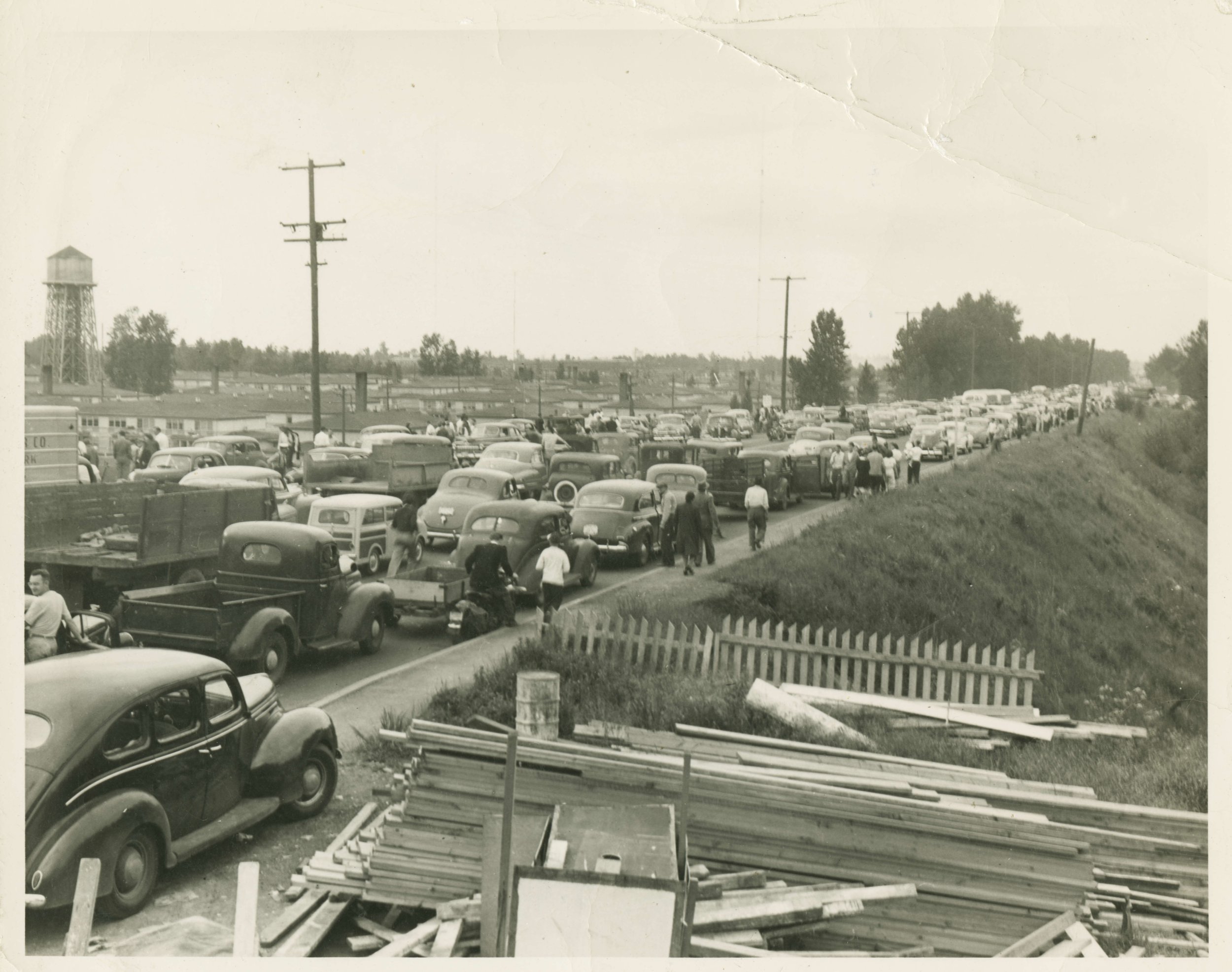
The flood rushed in with shocking speed, submerging the entire city in hours. Families fled with only what they could carry. Some escaped on foot. Others piled into cars. Entire buildings were lifted from their foundations and swept away. Miraculously, the official death toll was relatively low—15 lives lost—but over 18,000 people were left homeless.
And Vanport? It was gone. Completely.
Why It Happened
Several key factors led to the disaster:
Location: Vanport was built in a floodplain, below river level, protected only by levees and dikes.
Design: The city’s infrastructure was temporary by design, lacking the resilience of permanent urban neighborhoods.
Warnings: Officials downplayed risk, failed to evacuate early, and withheld timely alerts.
Politics: Vanport's status as a federally managed, low-income, racially diverse community left it with few defenders in the halls of power.
The tragedy wasn’t just natural—it was political and preventable.

Vanport Before the Flood: A Bustling Wartime City
Vanport, constructed swiftly in 1942 to house wartime shipyard workers, was Oregon's second-largest city at its peak. The following photographs capture the city's infrastructure and daily life prior to the flood:
Aerial View of Vanport: This image showcases the city's layout, including residential units and communal facilities.
Vanport's Residential Areas: Depicts the typical housing structures provided for workers and their families.


The 1948 Flood: Vanport's Sudden Demise
On May 30, 1948, a breach in the Columbia River levee led to the rapid inundation of Vanport. These photographs document the immediate impact of the flood:
Floodwaters Engulfing Vanport: An aerial perspective showing the extent of the flooding.

Aftermath: The Ruins of Vanport

The flood left Vanport in ruins, displacing thousands. These images reflect the devastation:
Destruction of Infrastructure: Shows the remnants of buildings and roads.
A Legacy Buried Beneath the Slough
After the flood, the land where Vanport stood was bulldozed and repurposed. Today, it’s home to Delta Park, Portland International Raceway, and Heron Lakes Golf Course. There’s little to suggest a city once stood there.
But Vanport’s legacy lives on in Portland’s housing debates—in the fight for fair access, in the memory of displaced communities, and in our collective reckoning with race, class, and disaster.
Why It Matters Today
As a real estate agent in Portland, I believe in knowing the ground we build on—literally and historically. Vanport is a stark reminder of how housing policy, urban design, and civic responsibility intersect. It shows us that where we live—and who gets to live there—is never just a question of bricks and mortar.
It’s a story of resilience, injustice, and memory. And it’s one every Portlander should know.


